Peru Thirty Years On: 1989-2019
By Natascha Scott-Stokes © —
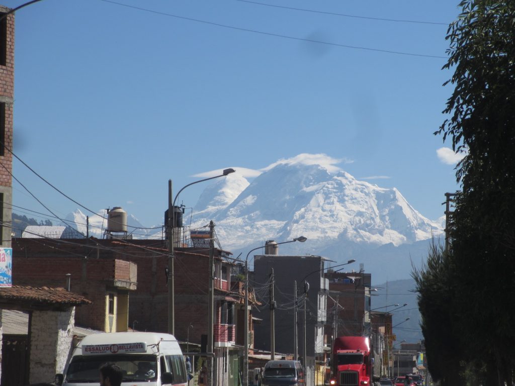
I arrived in the Callejón de Huaylas, eight hours north-east by bus from Lima, to a pink sunset reflecting off the snow-capped peaks of the Cordillera Blanca, and my heart thumped as much for the 3000m altitude as for the mighty vista of a glowing Huascarán (6,768m) visible at the end of the valley. How I had loved that view thirty years ago, and how happy I was to see it again now, a tantalizing icon of the Peruvian Andes and all the joy and heartbreak they contain.
In 1989, I seriously considered making my life in the valley’s capital of Huaraz, but ambition and the terrible violence unleashed by the Sendero Luminoso guerrilla war persuaded me to leave. In the end, as I discovered back then, chasing your dream is never the end of the story. There is always another one.
My return this year is not at all about trying to relive the past, and yet I am deeply thrilled to find my favourite place to eat grilled guinea pig with crisp papas doradas still exists, and I spend my first evening in a blissful haze, savouring a flavor I have not experienced for three decades, washed down by a Cusqueña beer that made sleep very easy. As if to order, a full moon rose above the jagged rim of the valley, and I closed my eyes with a profound sense of gratitude for the luxury of a private room at the Andescamp , my new home for a week.
My aching head and a racing pulse dictated a slow start, so I took a colectivo (fixed route minivan) to one of the city’s miradors (viewpoint). But I was disappointed to find myself bumping along a suburban track lined by garbage and half-built houses, and the viewpoint was just a bend in the road overlooking urban sprawl. My second attempt was much more successful, however, and this time I was transported up into a more bucolic setting of Quechua women sorting corn to dry in the sunshine, and pigs and donkeys nibbling grassy verges.
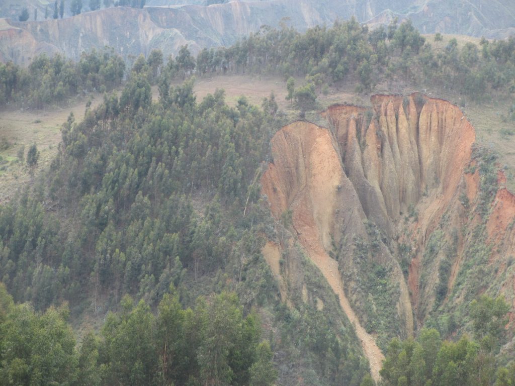
The 12th century ceremonial mound of Wilcahuaín, where the pre-Inca Wari civilization once buried their dead, was my destination, conveniently perched on a ledge above adobe homes and picture-book Andean pastures, 400m above the valley floor. The city of Huaraz below bears no relation to the place I knew in 1989. The population has increased by 100,000 people and the valley bowl is lined by thickets of iron and concrete constructions. A rash of half-built homes clings to the more vertiginous hillsides and I am not surprised to be told they are all illegal and in grave danger of being washed away by the next winter rains. Ridged gashes all over the valley indicate a dangerous erosion problem.
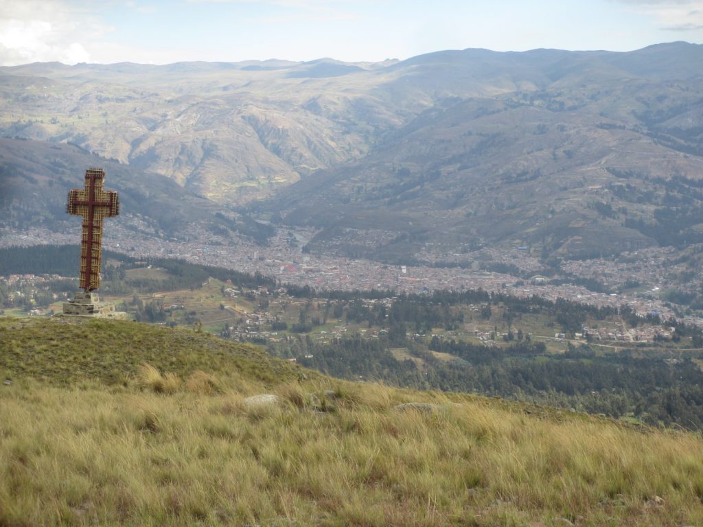
I could not resist heading for the fine cross mounted on a windswept knoll above Wilcahuaín, though my pounding chest made breathing difficult and I was glad there were few witnesses to my first day’s attempt at gentle hiking. I took it slow, breathing in through my nose and out through my mouth to avoid dehydration, but no in-breath gave me enough oxygen and I was quickly panting like a dog with my tongue dry and my body wet in sweaty effort.
My hostel was full of friendly trekkers from all over the world and it felt odd, but enjoyable, to be just another tourist among them: a little silver-haired lady this time, hardly worthy of a glance from the lovely young French and Israeli girls, though I did merit respectful conversation from the polite young Americans. I am old enough to be most people’s mother and the phrase ‘been there, done that’ comes to my mind, though I try hard not to say it out loud.
I don’t want to be that boring person regaling people with stories of the past, but I do find it hard not to mention why I am here and how Huaraz has changed, and the travellers as well. Hardly anyone I see is planning their adventures with actual hard copy maps. Everyone is on cell phones complete with snappy apps and Google maps. One girl proudly shows off her satellite GPS emergency tracking system, and I force myself not to say I prefer my old-school orienteering skills of actually noticing real landmarks and remembering significant signposts, not to mention being able to decipher a geographical contour map.
Part of me is attracted to the comfort of the trekking circuits offered by the hostel, complete with guide and donkey drivers to carry your stuff, and a cook to provide banana pancakes for breakfast. Apparently, they even have a portable toilet tent. But no, my pride (and my purse) cannot possibly allow me to participate in that kind of experience.
A maximum of 25 tourists per tour group now trek daily along paths where I once stumbled alone and tired; and yet I would choose that solitary journey with all its hardships and loneliness over the safety and comfort of an organized tour every time. I would like to think this is not just bloody-minded arrogance, but more to do with a sincere desire to hear and feel the landscape around me without the excited jabber of others blocking my ears to the delicate birdsong, and my attention to the very sensual pleasure of resting on some mossy wayside, with nothing but a dry piece of bread and the deafening silence of the mountains. How else to notice the subtle life of these places, where a distant splash of pink might indicate a Quechua woman washing clothes in a hidden brook, or a passing dot in the sky a silent condor cruising a hot air current.
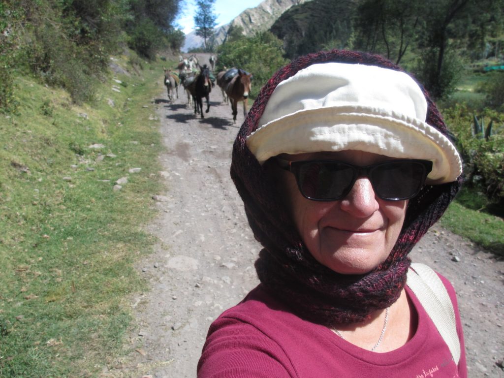
Soon I was itching to get up into the Cordillera Blanca lining the lovely valley of Huaraz. I decide to aim for Laguna Churup, not least because it seemed the trail begins by the village of Pitec, an hour’s drive out of the city by colectivo. But it was not public transport in the ordinary sense, for no one actually lives at the trailhead. The service is entirely for the benefit of trekkers; but at least I could tell myself I was travelling under my own steam – just like all the other foreigners on the bus!
On arrival, we are parted with 30 Soles (US$9) each by a business-like ranger for the Huascarán National Park, and I am glad I have enough cash, for no-one told me to expect this. But the UNESCO Biosphere Reserve is clearly in need of protection, especially if the explosion of visitor numbers and litter is anything to go by, and I am glad to do my bit for sustainable tourism.
I am quickly overtaken by my eager companions, as we head for the lake, which is at 4,450m above sea level, and I am glad to be able to wheeze in private, and enjoy the silence I crave. Just before reaching Laguna Churup, an agonizing series of rocks have to be negotiated by using metal cables fixed into the granite, and my tired thigh muscles tremble with the effort. I fear the puny strength in my arms is not enough to sustain me, and my relief at making it to the crystalline waters of the lake is somewhat tempered by fear. ‘Stay calm, be slow,’ I admonish myself, as I try to steady each foothold during the descent.
“If I don’t come back, you know where to look,” I had joked to the hostel manager.
But my flippant comment didn’t seem quite so funny now.
I was last down the mountain, but proud to note it was precisely 3:32pm. The colectivo driver had firmly said he would not wait past 3:30pm, and I was very relieved no one could accuse me of holding up their schedule.
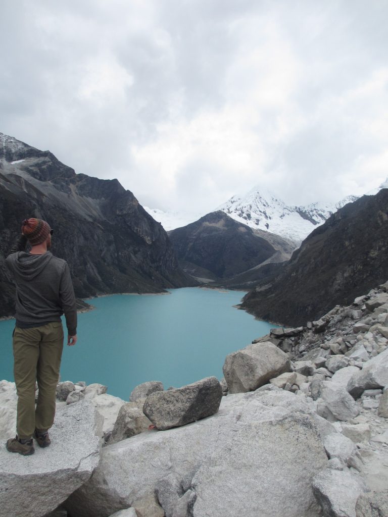
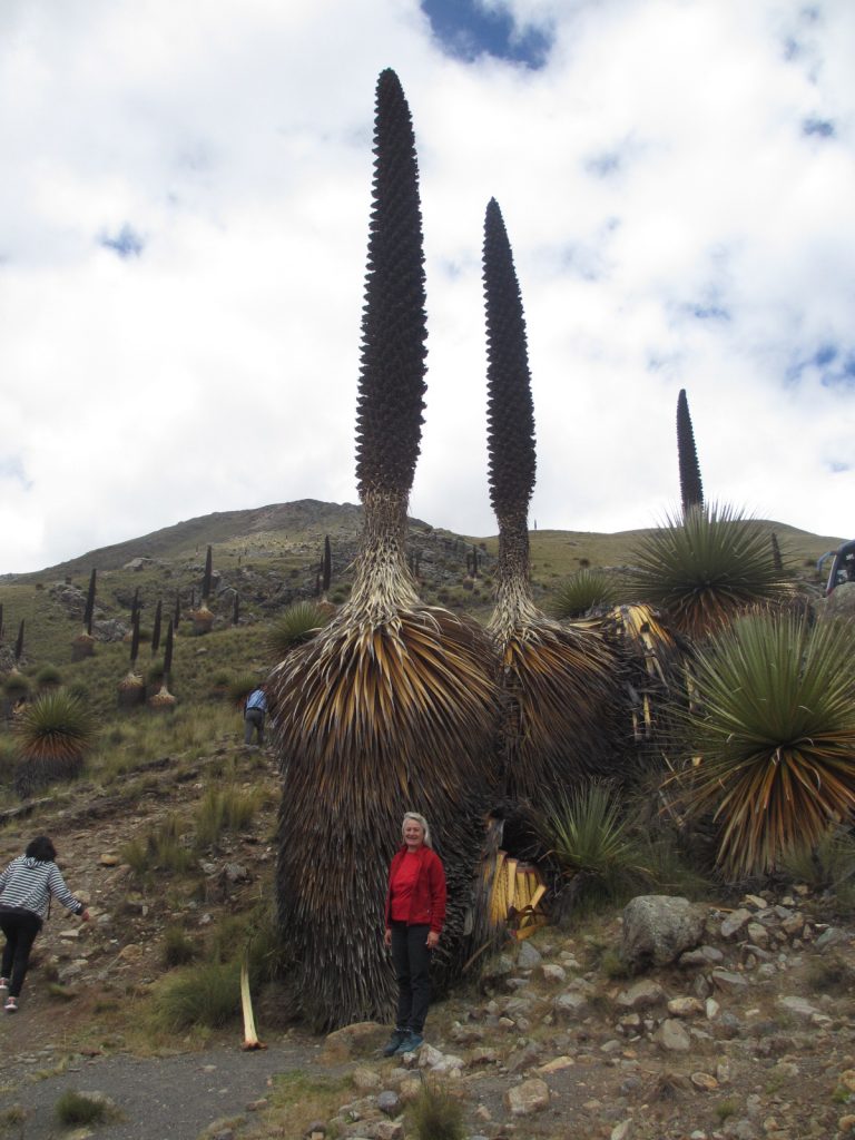
The easy option of affordable day-trips out of Huaraz has an addictive quality, as each evening is taken up with sociable conversations comparing notes, and I was happy to participate by visiting aquamarine Laguna Parón (4,155m) at the northern end of the Callejón, and the great sweep of the Pachacoto Valley leading to the Pastoruri glacier (5,240m) to the south, where the mighty Queen of the Andes (Puya Raimondi) stands guard over the grasslands of high puna.
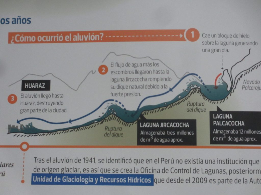
Taking those tours provided me with a quick re-introduction to the Andean landscape I love and the sun-kissed valley with its teeming villages, including Yungay, famously obliterated by a huge landslide that came off Huascarán during the 1970 earthquake. The tragedy is in no way forgotten, as the 50th anniversary approaches; and yet people have built new houses in the line of certain death from potential aluviones (landslides) that threaten the valley more and more, because of the catastrophic impacts of climate change.
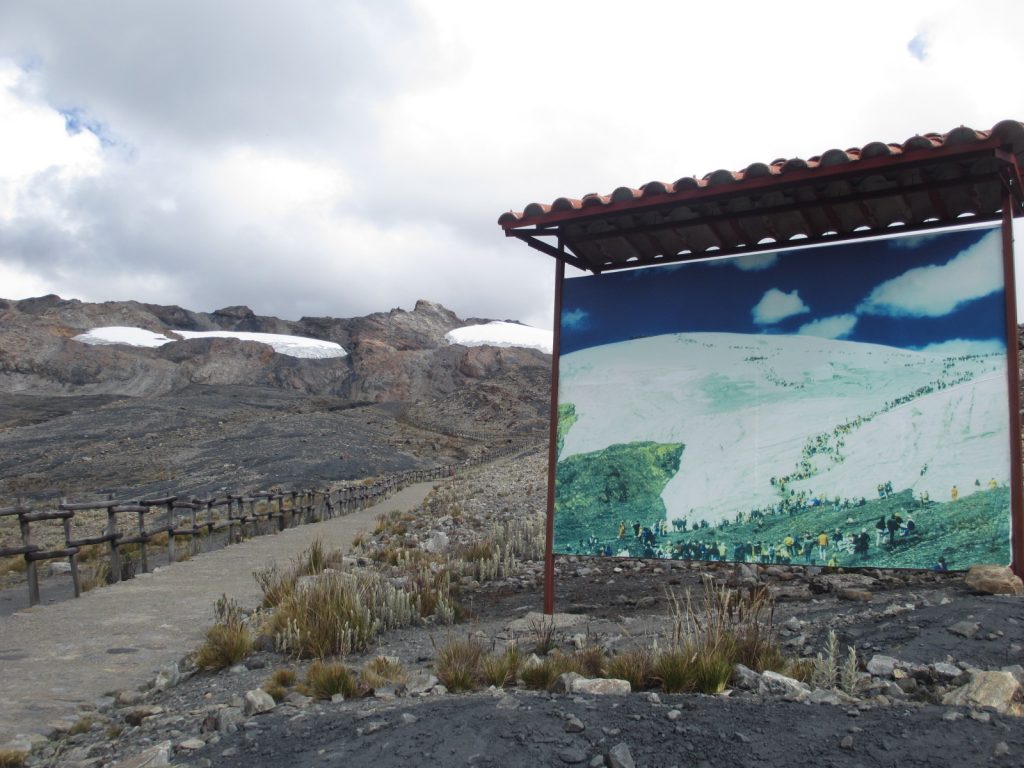
With luck, the snow and ice may survive another eight years, I was told, and it was certainly a shock to see how much of the Cordillera Blanca has turned the rusty colour of a dirty BBQ. Glacial melt is not only a threat to physical safety either, but also signifies the end of renewable drinking water for the hugely increased population and the mass of annual visitors.
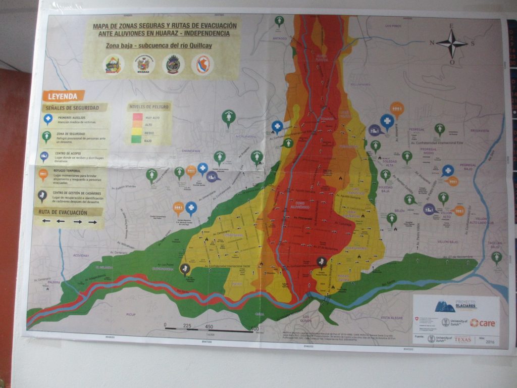
Yet the combined forces of poverty and a reckless fatalism engrained in the local culture continues to tempt people to build on unsafe land, and the political will to combat unsustainable water consumption, much less carry out the vital engineering works on the hugely increased bodies of water above cities like Huaraz is not there, according to one official I spoke to. It is a deadly combination, capable of exacting a terrible price. A significant number of the lovely lakes in the Cordillera Blanca are time bombs – but few people want to talk about that, least of all the local tourism industry.
Part One — Thirty Years On — was published Sept. 12, 2019
 The author of travel and biography books, Natascha Scott-Stokes (www.quintaescondida.com) established herself as a pioneering traveller in 1989, when she became the first woman to travel the length of the Amazon River alone, from its headwaters in the Peruvian Andes to the Atlantic off Brazil. She has been based in Chile since 2006, homeland of the artist Violeta Parra, who composed the song ‘Gracias a la Vida’, made famous by Joan Baez and Mercedes Sosa.