Peru and Chile on Tuesday signed an accord establishing the final coordinates for a maritime border that had been under dispute for decades.
The signing of the agreement, which was done at the Foreign Affairs Ministry in Lima, was called “historic” by Foreign Affairs Minister Eda Rivas.
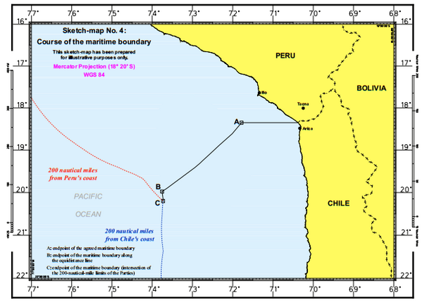
“It is a historic day for us because with the signing of this agreement we complete work that has been done by commissions… to pinpoint the coordinates for the maritime border between Peru and Chile,” she said in comments reported by state news agency Andina.
 In January, the International Court of Justice at The Hague ruled on a long-time border dispute between Peru and Chile over fishing-rich waters off their Pacific coasts.
The area under dispute included some 38,000 square kilometers of fishing-rich waters that Chile had controlled. Another 28,000 square kilometers of ocean was also under dispute. Peru had claimed that area, while Chile had argued that it should stay under international jurisdiction.
The judgment gave Peru the right over almost 50,000 square kilometers, which is over 70 percent of the area that was at stake.
The previous border was a straight line that stretched 200 square kilometers out from the Peruvian and Chilean land border. The new ruling stretches out 80 square kilometers from the border and then slopes south, giving Peru more control over the ocean waters.
The court didn’t determine the exact coordinates for the border, which it left up to Peru and Chile to do.